Himalayan building boom exposes at least 300,000 people to potential disasters
A study of parts of Nepal, Tibet and India's Uttarakhand finds rapid construction growth in areas vulnerable to river floods and glacial lake bursts.
By Kavya Robinson ·
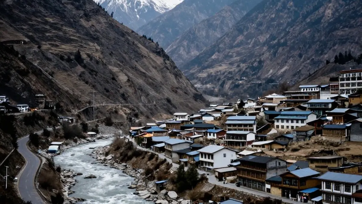
At least 300,000 people could be living in the path of potential Himalayan disasters as construction spreads through vulnerable river valleys, a new study suggests. Researchers found that built-up land in high-risk areas of northern Nepal, south-eastern Tibet and a corner of India's Uttarakhand increased by about 45% between 2016 and 2023. Development in areas particularly exposed to flooding from glacial lakes rose by almost 78%.
Published in Scientific Reports, the peer-reviewed study involved nine researchers from the UK, Nepal and India. They examined areas extending up to 50km downstream along Himalayan rivers and around 1,360 glacial lakes, identifying growth in tourism facilities, infrastructure and property development. The researchers said the population at risk could be considerably larger because neighbouring areas facing similar dangers were outside their analysis.
The research preceded devastating floods in Nepal in August that killed more than 1,400 people and left thousands missing. Flooding along the Budhi Gandaki river on 11 October subsequently damaged 200 houses, destroyed five bridges and left five people missing. The study counted buildings within 50 vertical metres of river or glacial lake surfaces as at risk. However, residents of Rasuwa district reported water rising by 70m in places during the 26 August disaster, suggesting the exposure could extend further.
In Pokhara, a tourism centre below the Himalayas, Mayor Dhana Raj Acharya said older buildings stand just 5m from river banks despite newer setback requirements. The Seti Gandaki River runs through the city from the Annapurna mountain range. Relocating people presents a major difficulty. Further north, Annapurna homestay operator Phurpa Chhiring Lama said just five of his 20 rooms were occupied during the peak trekking season, when he would normally be full.
Laxman Subedi, president of the Hotel Association Pokhara, acknowledged that tourism businesses had grown without adequate planning and said the association was raising awareness among investors and operators. Construction pressures also extend beyond tourism, with substantial hydropower development around the Bhotekoshi and Trishuli rivers. Lead author C Scott Watson, a University of Leeds glaciologist, warned that decisions about increasingly populated valleys would influence disaster exposure for decades.
Scientists say the Himalayas are warming at twice the global rate. Faster melting of glaciers, snow, icefields and permanently frozen ground can weaken mountain slopes already affected by earthquakes. Meltwater also enlarges glacial lakes until they overflow or burst, with Nepal recording around 30 such floods since 1940. Rising temperatures bring rain to elevations previously receiving only snow, contributing to slope failures and falling rock and ice.
Alton Byers, a University of Colorado mountain geographer who was not involved in the research, said the findings should encourage better early-warning systems and precautions. University of Nepal urban planning expert Prof Surya Raj Acharya said roads, hotels, hydropower schemes and towns had spread across accessible, flat riverside land, often without adequate safeguards. Campaigners say weak enforcement has allowed poorly planned development to continue.
Nepal's national disaster agency says settlements within 15m of river banks along the recently devastated Rasuwa-Bhotekoshi corridor will soon be prohibited, with similar measures planned elsewhere. In Uttarakhand, activist Anoop Nautiyal accused authorities of failing to enforce existing restrictions. The state government approved new floodplain zoning rules on 12 October to regulate development and protect people, property and infrastructure while preserving floodwater flows.
Basanta Raj Adhikari, director of Tribhuvan University's Centre for Disaster Studies, said the threats could not be eliminated entirely. He proposed mapping areas by risk level so insurance coverage could encourage construction in safer locations. Across the region, however, building activity continues without signs of slowing.
Source: BBC News